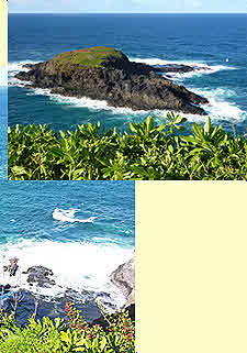
 Hanalei
River Valley
Hanalei
River ValleyPrinceville
 Kauai
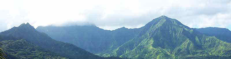
is called the Garden Isle for a reason. The second highest peak is Mount
Waialeale and, at 452 inches, it is the wettest place on earth. Just
a few miles to the south, travelling down Waimea Canyon - the Grand
Canyon of the west - the city of Waimea is on the southern coast, a
fairly dry area. Kauai has everything, but is generally very lush and
host to a wide variety of plant life.
Kauai
is called the Garden Isle for a reason. The second highest peak is Mount
Waialeale and, at 452 inches, it is the wettest place on earth. Just
a few miles to the south, travelling down Waimea Canyon - the Grand
Canyon of the west - the city of Waimea is on the southern coast, a
fairly dry area. Kauai has everything, but is generally very lush and
host to a wide variety of plant life.
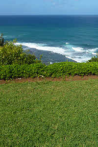
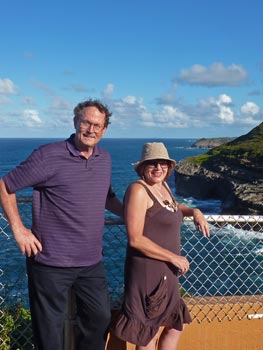
It is on this island that we own a timeshare and try to visit when we need a peaceful vacation. We arrived in Lihue and drove north to Princeville, where we would be staying the week. The accommodations are quite large and the back patio fronts a partial view of the ocean.
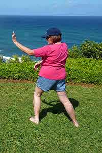
In the morning Patty would go to the cliffs overlooking the ocean on the north side of the island and practice her Tai Chi routines. There can't be a more beautiful and peaceful place to perform these exercises.
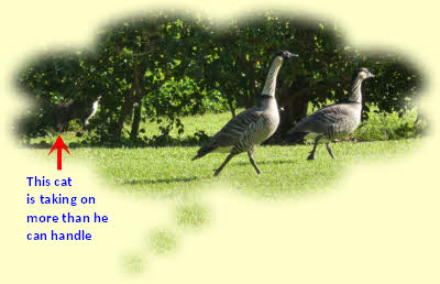
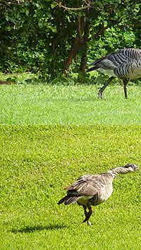
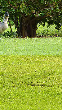
Sitting on the patio we saw all sorts of birds and wildlife passing by. In particular it was amusing to view ducks walking by; especially when a local cat tried to stalk them.
 A
number of times we walked from our property a couple of miles into Princeville.
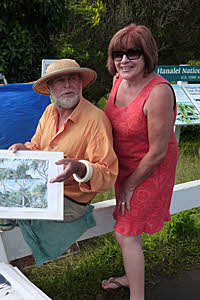
We ate dinner at a couple of restaurants there, but the highlight was
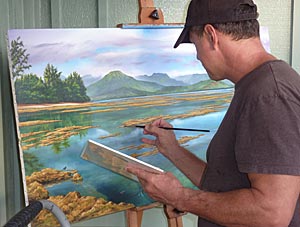
stopping by Patrick Ching's art gallery and watching him painting a
Hawaiian scene that was simply majestic - Hanalei Tide - shown in finished
form below.
A
number of times we walked from our property a couple of miles into Princeville.
We ate dinner at a couple of restaurants there, but the highlight was
stopping by Patrick Ching's art gallery and watching him painting a
Hawaiian scene that was simply majestic - Hanalei Tide - shown in finished
form below.
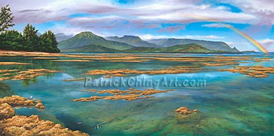
Click on the finished painting to go to his website.
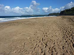
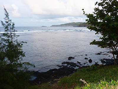
Hanalei Bay
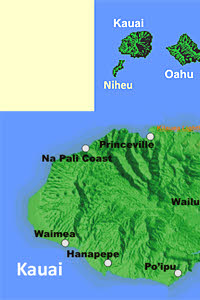
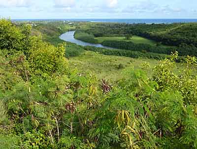
Princeville sits on a bluff overlooking Hanalei Bay on the west. Beyond the bay the road stretches a number of miles and ends at Haena State Park. This is the starting point for hiking down the Na Pali Coast - not for the faint of heart, nor the casual hiker. The road runs completely around Kauai, except for the Na Pali Coast; meaning when we want to go to the Waimea Canyon we have to go back the way we came, almost all the way around the island.
Going from Princeville down to the city of Hanalei, there is a one-way bridge that sometimes floods out in the early spring - isolating the residents of Hanalei.
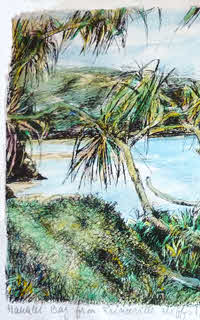
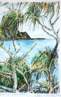
It is at the overlook, from which we shot the picture on the left, that we ran into an artist several days running - Ales Sedlacek - doing watercolor painting. We finally bought the view of Hanalei Bay from the Princeville cliffs.
On the other side of Hanalei is what is known as Bali Hai Beach - where they filmed South Pacific in 1958.

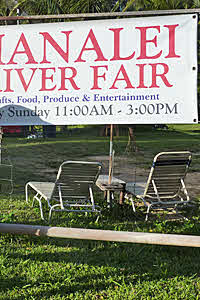
Coming back into the city Patty stopped at Hanalei Beach Park, where there is a Farmer's Market each weekend.
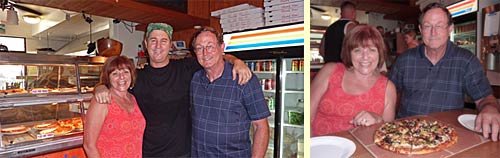
Finally we show a Pizza joint and Carlos, the owner - who everyone on the island seemed to know - with absolutely delicious pizza made of everything we both like. We went back several times and recommend his place - Hanalei Pizza in Ching Young Village - to anyone visiting Kauai.
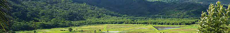
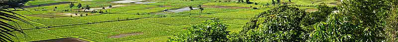
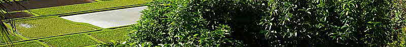
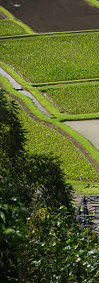
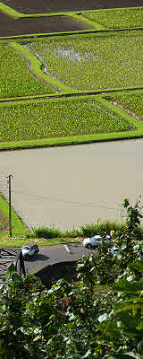
Taro Tour
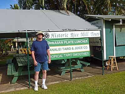
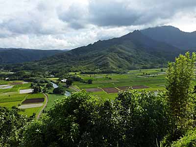
The pictures of the Hanalei River Valley all show the Taro Farm that dominates the valley floor.
Along the river are buildings that used to be used to process rice - back when rice was a big crop in Hawaii. Now one of the buildings is a Rice Production Museum, but no pictures were allowed while we were in the building. Other buildings are used to process the Taro harvested across the valley.
We took an interesting tour of this area.
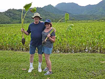
The tour started in the Taro fields where we were told how the plants grew, how much trouble it was to keep troublesome insects out, and how hard it is for small farmers today.
Part of the tour was to prepare a Taro delicacy for us visitors.
First the plant is ground up by hand and then it was wrapped in leaves for us to sample. It wasn't bad, but is certainly an acquired taste.
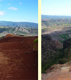
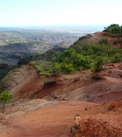
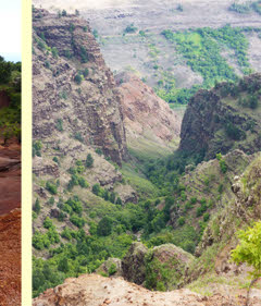
Waimea
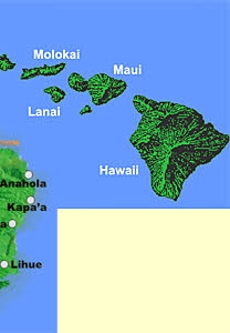
We took a drive around the island, from Princeville, through Kapp'a, Wailua, Lihue, Waimea, to Waimea Canyon State Park. It was a two lane road almost all the way around - don't try this drive during rush hour.
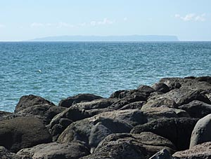
On the way we got the best - and only - view of the island of Nihue. This is an island only native Hawaiian aniians can visit, so it always looks mysterious to the rest of us.
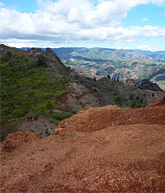
After passing through the city of Waimea, we climbed steadily up the mountains into Waimea Canyon State Park. The views here certainly reminded us of the Grand Canyon, with the dominant red clay coloring. This southern side of the island was certainly much drier.
Kilauea Point
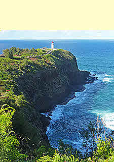
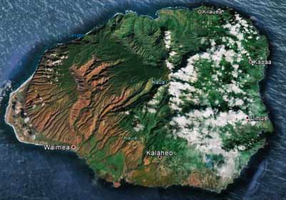
On another day we drove to Kilauea Point National Wildlife Refuge - one of our favorite site seeing places in Hawaii. The beautiful cliffs and island to the north of the lighthouse just invite pictures. The illegible orange writing in the map above identifies Kilauea Point.
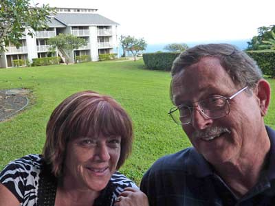
Of course Craig looks pretty windblown in this shot of us.
When we took a road around the coastline to the west of the point we were able to get another view of Kilauea and it's island. It was here that we shot the sunset included as an introduction on the main Vacation page.
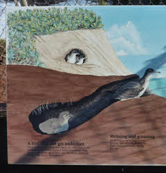
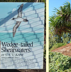
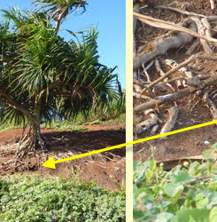
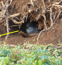
This is home to the Wedge-tailed Shearwaters, who burrow into the ground to build their nests.
Kapa'a and Wailua River
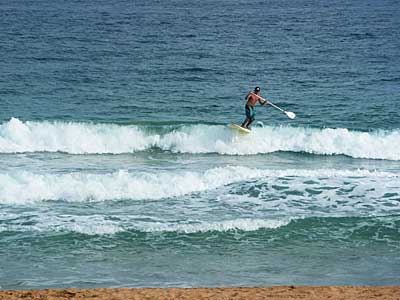
We took a couple of trips part way around the island to the eastern city of Kapa'a. Here is a picture taken north of the city where paddle surfing with a surfboard was very common.
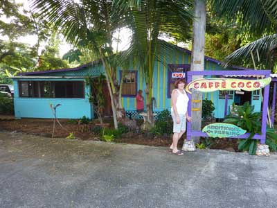
In the city we stopped at the Caffe Coco - on the advice of Carlos, our pizza buddy - and enjoyed our conversation with the owner.
The food was vegetarian and very good.
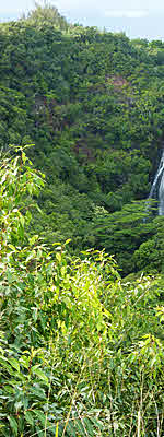
A few blocks south of Caffe Coco is the Wailua River and we followed it up to Opaekaa Falls. This is the site of a picture we took of Patty's sister Joan in 1998 - special because this was her last vacation and we were glad she enjoyed it.
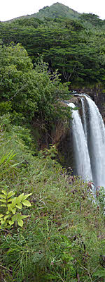
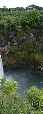
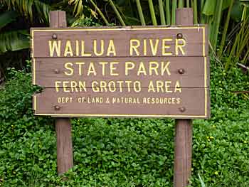
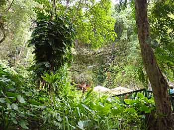
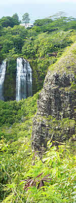
On our last day we took the boat tour up the Wailua River State Park - Fern Grotto Area. After the tour we drove around the area from the back and got to view Wailua Falls - finishing our touring and bringing us back to the airport in Lihue, where we boarded our plane home.